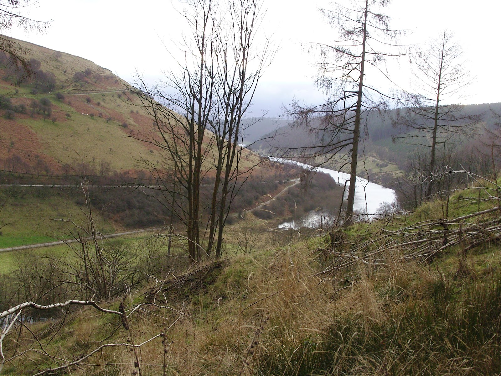
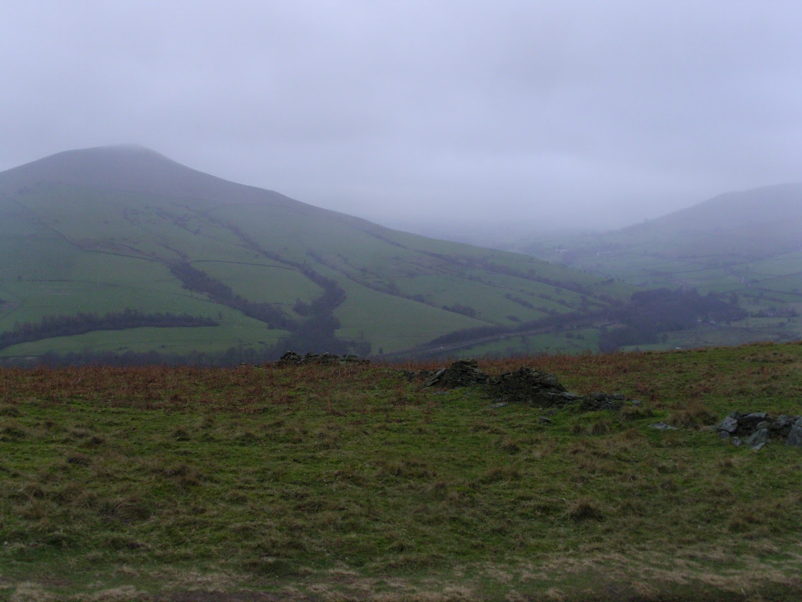
Sunday, 26 February 2012

17 to 1. Time for a dram.

I am officially Number 1 on the Standby List.  So I have got the whisky out.  


Have one with me, will you?

Tuesday, 21 February 2012

It's all downhill from here..

So, the progress is slow but, as with any long-distance walk, if you keep putting one foot in front of the other you will always reach the end.  I'm on that part of the journey where you are up high, coming down from the summit and you can see the car in that spot just off the road.  Its a way off, but you know you will get there.

The latest from Challenge HQ is that I am placed at Number 5 on the Standby List.  This has given John enough confidence to email the route and admin sheets through to me so I can have them ready asap.  Naturally, I am well prepared so they were already in place, ready and waiting.  I've had it given the once over by trusted new friends and it looks good - low, and good, and a wee bit wild.

As I said, I am on the stretch where the car is in sight, only there is one difference.  The car is just the start of the journey...

Sunday, 19 February 2012

The Larks ascending...

I was almost going to miss out on getting a walk in this weekend, until I had a brainwave last night and decided to get up early this morning and go for a quick blast as fast as I could (with the pack of course).  No photos this time as it was purely a leg stretch.  You will have to imagine the crystal clear skies, and wonderful low sunshine, warming the frosty earth.


I'm 10 minutes walk from the Stour Valley Path (that's Path, not Way) so I jumped on that for a bit and back over the farmland into town for about six miles at full pelt.  I hardly felt the pack, which made me smile as I took a gamble based on advice received from numerous challengers/backpackers.  I bought a lightweight pack from Lowe Alpine, the Crag Attack 42.  It's smashing, although it misses out on a mesh pocket for wet stuff, but that's a small price to pay.  It fits nice and weighs less than a kilo and I can't pack much in it, which in turn means I can't pack too much!


Anyway, this walk - as I mentioned - passes through farmland and that is why I named this post "The Larks ascending...".
For the first time I can recall this year, I heard Skylarks chirruping and rising from all directions.  I'd forgotten about this spot for seeing 'larks, and it is truly brilliant for them.  I managed to get a good view of a pair courting on the ground, before doing their distinctive pursuit flights.  All the while, many others were suspended from the sky like little model aircraft on strands of cotton hanging from my bedroom ceiling.  They truly never stop singing.


So here is what Ralph and Nicola make of those 'larks....


If you are interested, I got round in 1hr 30min including the pauses to take my fizans off my pack and also to admire those larks.  I was back in time to get the kids (and Mrs M) up and make them breakfast.  Lazy tikes, my lot. 

And for those who are into the boot v trainer debate, my New Balance 570 AT's felt lovely - old and knackered, but lovely.

Night folks.  Hope you enjoyed the 'larks.

Monday, 6 February 2012

Mixing business with pleasure in The Cheviots

It's a smashing thing when business takes care of pleasure and that is exactly what it did for me this weekend.  There's a bit of garb and pre-amble here so feel free to scroll down for the photos. ;-)


A client meeting in rural Northumberland, not much more than a midgie's widgie outside the Northumberland National Park set my mind scheming.  It didn't take me long to put a route together.  


I pointed the car North at around 7am and arrived in Wooler at just after 1330h.  The next few miles to Langlee up the Harthope Valley took around ten minutes on account of the windy nature of the lane.  As I crept along the tiny lane the snow, scarce until now, began to fall more heavily.  There was a keen and wintry Southwesterly blowing the white stuff straight into my face as I got out of the car.  I shouldered my pack, and locked my car.


I was heading up to the Cheviot, and on over to the mountain refuge hut just six miles away from the car, only I wasn't  because I didn't like the snow and wind in my face at all.  I turned around before I had got very far up the hill and slipped back into the calm cockpit of my car.  Not today, I thought.  


But no digs were booked, and there were clear signs instructing no camping in the valley itself.  It was just raining down in Wooler and I went to the first of two camp sites, parked the car and knocked at the house as instructed.  I was greeted by a friendly chap who said I could camp, but the toilet block wasn't open.  Not minding missing out on a wash and brush up, I got my mind set on getting the tent up.  Before I did so, I asked if the chap would open the loos for sanitary purposes and I was politely reminded that I could camp but the toilet wasn't open.  I pondered what the chap might have done with the curly, steaming pile that I would have to leave by my tent in the morning before thanking him and asking if the other site was open.  It was not.


I headed up to the Youth Hostel - closed for the Winter.  I pondered on camping on their lawn, thinking they wouldn't mind, but then the necessary ablutions sprang to mind.  
Back into the car and round to the Tourist Information.  "Hi there!" I smiled.  "I'm looking for some basic accommodation" I continued.  "I have a tent if necessary".  The very helpful middle-aged lady looked at me, looked outside at the sleet and then said have you tried the camp site just up the road."  "Closed" I replied, "they both are".  The computers were down, and the poor lady was stranded without them.  "Ah, there is the Youth Hostel" she offered.  "Closed for the winter..." I said "...there was a sign up".  She frowned as if to disagree.  "I'll check" and after helping a lady who had arrived to give a talk on Family History with a computer demonstration, she moved into the office and called Rachel.  "Rachel says the Hostel is shut until Spring". "Oh right, well that is what the sign said" I said, stunned.  
"You could try one of the B&B's in town.  There's the Black Bull, and the Wheatsheaf, but I can't recommend the Wheatsheaf because it hasn't been inspected yet".  "I could give them a call, I think I can remember the number".  I glanced down at the large pad of tear-off, Tourist Information maps of Wooler, noting the advertisement posted by the Wheatsheaf showing their number.  I decided to let her carry on.  "Here's a list of accommodation with phone numbers, try these".  "Start with the Black Bull, but ask to see the rooms first, and make sure you don't get one at the front" she babbled.  I thanked her and left her complaining about how bad things would get in the Summer with just her manning the desk and the library, and closed the door.  As the door closed I could hear her telling the lady doing the family history talk that she couldn't use any of the computers.  Good luck with that, I thought.


I booked into the Black Bull, accepting the first room I was offered and settled for the evening.  The weather continued to be miserable, the locals coming in wet and windswept.  Still no snow in the town, my mind was cast to the hills.


The alarm woke me at 0730h and I pulled back the curtains to reveal...    ...glorious clear skies and a sharp frost with no wind.  FABULOUS!! I was fearing a sopping wet, or windy climb today.  I got my gear together, dashed down to wolf my breakfast and after exchanging a few pleasantries with the breakfast staff I jumped into the car and drove back up the Harthope Valley - gingerly.  There was a thick icy rime encrusting the road.  The wet wintry stuff had frozen solid and I thanked my lucky stars that my car had four-wheel drive as I edged my way up the 1 in 5.  I thanked them again as I nosed it down a similar decline.
I drove as far up the valley as I considered sensible passing just two walkers on the route.  It was just after 0900 and the drive which yesterday took just ten minutes or so, took double that.


I positioned the car so as not to get it stuck and got my self together.  The chaps I had passed in the car had reached me and we swapped routes and joked a bit before they left me to adjust my walking poles.  The weather was just perfect for a winter walk.  The cold was there, but without the wind it was completely bearable, just a baselayer, microfleece and my body warmer saw me just right to set off.  No hat yet, but gloves were required.


Before I got onto the hill I had a short road walk.  The wet snow from the previous day had turned to thick slush before it froze, making the entire lane like a cobbled ice-rink.  I stuck to the verge and avoided the likely tumble.  Stupidly, I hadn't packed my crampons, and promised myself I would retreat if all was frozen up high.
The rimey road, Hedgehope Hill in the distance.
At first path took me up between the trees for a hundred yards or so.  No sooner had I emerged above the tree line did the grouse start calling.  They were everywhere.  I must have seen twenty or thirty within the first mile of the climb.  Visibility was a treat and as I climbed higher, the Eastern lowlands of Northumberland revealed itself.  All below the valley, and even to the North was largely snow-free.  All above me was not.  

Hedgehope Hill from the flanks of Scald Hill
Mr Red Grouse
There had been a lot of snow the previous night and I patted myself on the back for turning back.  It would have been nasty up in the refuge, although part of me regretted it because waking up in the hills to this beautiful morning would have been an absolute treasure.
Further up the hill, the wind had begun to carve its beautiful waves into the drifting snow, and I took a lot of snow photos.  Only my point and shoot doesn't have a viewfinder so I had no idea what they would come out like.  The answer was FLAT, so I played about with most of the photos on the computer.


The entire walk was a joy, even getting my legs stuck in deep drifted snow, and falling over onto my poles was a hoot.  It had been a while since I had played about in the snow, and boy, was it fun!  It had clearly been freezing as the snow fell yesterday because the going was lovely and soft - no need to retreat, thankfully.


Apart from the two lads on the road, who had chosen to climb Hedgehope Hill, I had seen no-one.  My prints were the first to grace the snow on the Cheviot that day, and it made the trip all the better.  I glamorised that I was pioneering some new route to the top, which was bollocks of course but I indulged myself.  Pausing often to take in the scenery, my ascent was languid, and lovely.  I glanced across to Hedgehope and noticed two matchstick figures on the skyline, I guessed that it was the chaps I had spoken to earlier and wondered if they had seen me larking about on my tod in the snow, falling over and laying down to take photos - allsorts.  I was in my element.  


Richardson's stile by the flagstone path
The huge ladder stile by the flagstone path was upon me all too soon, so once I had climbed it I sauntered slowly toward the trig point.  By now, I was enveloped in the cloud that was being tugged away from the summit by the Northerly breeze.  I could see probably 50 yards in any direction by the time I reached the trig.  I took a summit shot for the record and ruffled my hair.  It was frozen solid!  I cracked the ice off and as I turned to begin my descent a lone figure of a person with no pack on came strolling toward me.  I remarked that he made me feel a tad over prepared, and he just remarked that he "couldn't be arsed with a pack".  He was with some others who were following behind, so I kept the conversation brief and set off back down the hill.  
Me, with frozen hair - and a REALLY ginger beard!
I'd decided to return the way I came, thinking that the descent down Harthope Burn might be deep and drifted snow.  I practically skipped down the hill, and apart from a half dozen tumbles into some of the deeper drifts, it was an easy descent.  I passed a chap on skis heading up the hill.  They were squeaking like mad and I thought to myself how that would get on my pip all the way up, but then imagined what fun the descent would be.  Worth it?  Probably.  
Long Crags, a feature on the ascent up to Hedgehope Hill - taken from Scald Hill
Langlee Crags, another feature on the same ridge
A VERY well worn stile on the descent - beyond, the orographic cloud clings to the Cheviot
There was a lot less snow on my way back down and my earlier tracks were partly melted with the strength of the sunshine.  I met a Dutchman on the lower flanks, and he asked what it was like.  "Fabulous" I replied.
On reaching the road, all of the rime was gone and I strolled quickly back to the car, ending a perfect Winter day out on the hill.

Thursday, 2 February 2012

Come in number 9...

Latest update from TGOC HQ is that I am floating at number 9 on the Standby List.  Something to be said for patience but the Participant List is still tantalisingly out of arms reach at the moment.  


There are still 100 days to go (give or take).   I feel like a lurking scavenger, without a conscience!


Off to The Cheviots this weekend.  Weather - be kind.

Thursday, 12 January 2012

Never be afraid to change your plans Pt.2...

So where did we leave it last time?  Oh yes, I was awash with whisky and spaghetti bolognaise by Ladybower...


So we were both awake before dawn, but the first hints of light were beginning to materialise to the northeast.   The pocket rocket was fired up and a brew on the go within a few minutes.  Breakfast was one of those flapjacks that you will have seen on an earlier blog.  Not great, but the chocolate chips helped.  Black coffee always helps to kickstart me in the morning, in more ways than one, so a trip to the wilderness toilet was had.  The turf was replaced and a huge rock placed over it to ensure it didn't escape.  I resisted taking a photo - some things are best left unrecorded.


Today we had decided to walk the shore and join the road at the Ashopton Viaduct which would take us around to the westernmost point of Ladybower.  After the shoreline section, the road was not pleasant, although the A57 was thankfully very quiet with it being early on a Sunday.  


I think my wife must have been praying, because the teawagon on the A57 was there, open and a steaming cup of tea was ready for us to purchase.  A smashing chap runs that wagon - and I urge you to stop by if you are driving through.  Some nice fellas were in front of us, be-gaitered and ready to go off hiking.  One of these men appeared addled, and was clearly confused that he had lost something, but was making no sense when I questioned him.  He was ushered away by his 'pal' who I asked what he had lost - he too said he didn't know.  We came to the conclusion that he had some form of dementia.  That thought stayed with me and troubled me for a while after we left the lay-by.


After being caught short again, I had to catch up with Den who had walked on slowly ahead.  Every time I looked up - he looked back over his shoulder, and started running off.  This he did about a dozen times, until I finally caught up with him.  How we laughed.


Looking back down the Woodlands Valley over to Ladybower
The road section, despite seeming endless, was not and we crossed the bridge in the Woodlands Valley, just to the north of Hope Cross on the OS map.  There was a slight uncertainty as to which was our path onto Win Hill - our main target for the day.  A short walk ahead confirmed there were no other paths to take and that, coupled with the fact that Len's Path was clearly signed as a route onto the Roman Road, removed any doubt that this steep and dirty trail was the one we should take.

Len's Path, that's Den by the way, not Len
Occasionally we saw dirt-bikers, all of whom Den asserted were off-duty superbikers having a day of fun.  In fact I think we saw all of the following according to Den:


- British Superbike
- World Superbike Champion
- MOTO GP Champion
- TT Champion
- Eddie Kidd
- Evil Knieval


Each of these were on their DT50's with muddied out number plates.  I resisted the urge to stop them for their autographs.  Didn't want to bother them on their days off.


The initial distasteful appearance of Len's Path (now known to me as Den's Path) gave way to a really lovely route which became so at what appeared to be a small settlement at around SK164867.  For some reason I failed to take a photograph here, but I couldn't quite work out what these places were other than long deserted homes.  I wondered if the owners might have been cleared as in the Highlands.  
From these mysterious steadings the path leads through dense conifer plantation (which may or may not confirm my clearance wondering).  Despite my having a real dislike for dense conifer plantation, the path was a joy to walk, being sheltered from the wind and full of atmosphere.  Punctuated with lush and verdant grassy clearings to the southwestern side, this latter section of ascent eased off in steepness as we gained the ridge.  

The coniferous tube of Den's Path
The ridge took us by surprise for it was substantially broader than we expected.  The Roman Road section was largely easy walking and this was borne out by the myriad Sunday walkers in trainers and bomber jackets that materialised shortly after we popped out above the conifer line.


The views over to Kinder were fine at first, but Mother Nature seemed to have her felt pens out and quickly coloured everything to the west in grey.  She spared us for some time along this never-ending, long tongue of a hill.  It was a lovely place to be and I felt like I could have walked along it for hours.   I'd say from the point where we joined it, to the summit rocks, was around 2.5 miles of loveliness.  
There was a varied, sandy terrain of neatly grazed grass, interspersed with tussocks of tougher grasses, and heather in places.  There were several pits which dotted the top of the spur-like plateau and we wondered what they might be.  Evidence of open-cast mining - but of what?  Sink holes?  We remain clueless. 
The highest point is marked by Hope Cross which seems to have had its top stone removed and all that remains is the upright and a metal spike where the top stone once rested.  At least that is what I can glean from a quick Google search. I might have been looking at the wrong marker post I suppose(?).  Anyone got any better info?
Den on the Roman Road - summit bound
Some you Win.  Lose Hill from Win Hill

Grass, Heather, Sand, Erosion, Mist, and Den
After a brief spell of more closed in mist, the air cleared and the winds got up to full strength for the first time so far, the air being compressed on the prominent summit rocks of Win Hill itself.  We'd looked across to this pointy top some ten years earlier and vowed to 'do' it one day.  We never expected it to take us 10 years.  I suppose the Munros and Wainwrights got in the way.


The summit moment was poignant, but brief due to the gale-force battering we were getting so we set off downwards for a steep and very careful descent to Yorkshire Bridge. 
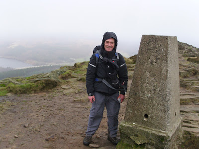

Den in his lovely new Spyder jacket.  The armed guards weren't far away
on account of its ludicrous value.   
Me at the Trig - you'll not believe the number of times that Garmin knocked me on the head.
Note to self - reposition next walk.  It didn't even get switched on!
Although a fabulous setting, the conditions underfoot were less than fabulous - ankle deep mire most of the way.  And folk were coming uphill in shiny white trainers!  I should add that a good many of them were not smiling.  
My trusty Fizan poles had had a good outing and continued to prove themselves by making this descent far less troublesome with them in hand.


We regained our knees for a spell at Yorkshire Bridge and I phoned home with a quick progress report whilst Den caught his breath with a much needed roll-up.  Nuthatches were shouting in the trees above us and as if to tease us, remained disguised by their silhouettes or hidden by the boughs.  A little way up the lane all manner of small songbirds erupted from the trees by the road and my eyes scanned for the cause.  In that moment the culprit, a male sparrowhawk, burst empty-handed from a bramble and flew off along the line of trees.  Doubtless cussing the wasted energy.  There's usually a moment like this on our walks, a real treat.

The next couple of miles along the peakland lanes were a bit of a slog, but I enjoyed getting into the rhythm with my poles.  I paused often to suck up the views down over Bamford, I remember thinking that it was a shame it would soon be over. 

Shortly before we reached the parking spot at Dennis Knoll - a honeypot for Stanage climbers - Den noticed the car, stile a mile or so away.  It was a welcome sight, and given that I couldn't see any bricks supporting the axles, I was all the more pleased.

We slumped into the car, checked the map for a while, scouting a pitch for the night, and headed down into Hathersage to fill the tanks and resupply.  After driving about looking for suitable spots to camp close to the road, we decided that we'd head for the North Lees campsite and pitch there.  It was a little soggy, the facilities were clean and serviceable - although the lights in the loos seemed to be switched off overnight and only came on after dawn - go and figure that one out.  Oh, and there was no cold water either.  Bear this in mind if you are thinking of staying.

Therein lies the tale of my first bit of backpacking in what seemed like an age.  How quickly one can get back into the groove.  Quite apart from the fact that our initial route plan was dumped on day one, we had a great walk, a good wild camp, and a memorable weekend outside.

I hope you enjoyed reading this as much a I did recording it.
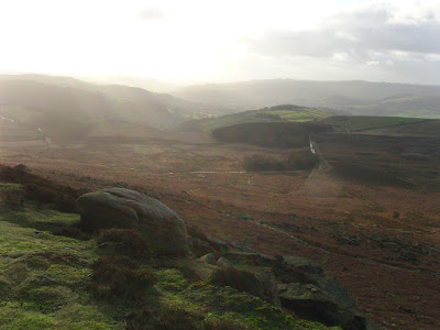
Finishing where we started, beneath Stanage Edge.

Monday, 9 January 2012

Never be afraid to change your plans Pt.1.

Den and I started off on plan, arriving at Hathersage by mid morning.  We wove our way up the lane to Sheepwash Bank beneath Stanage Edge.  The plan was roughly as follows:


1) Get up onto Stanage Edge, walk along it.  


2) Down to the A57, cross it.


3) Up to Derwent Edge, walk along it.


4) Find somewhere to camp up high.


5) Wake up, go down to Ladybower.


6) Over to Hagg Farm (why anyone would want to farm them, I've no idea), then up onto Win Hill to camp 


7) Return to car via the lanes, and paths.


7 easy stages in the wonderful English hills.  The reality had us telling a somewhat different story....


We huffed and puffed, straight out of the car yomping through the bracken, and sloppy sheep trails up to Stanage Edge buffeted all the while by the Westerlies.  Quickly we noticed we both had a permanent list to the Port Bow.


Looking over Dennis Knoll to the Pennines beyond
The going was good underfoot and the views tremendous, we had got lucky.  The sun was shining, and the air was dry.  The hoolie that was blowing, though, made my smooth blue line into a rather wiggly one.  Den and I bounced off the invisible wall of wind, into gritty puddles, and off into the heather.  We could barely even hear the kwok-kwok-kwokking of the grouse over the sound of the rushing air.  Ok, so I might be being a tad over zealous, but I have to - I'm building up to a route change!
Den on Stanage
No really, it is!
We got to the northern end of Stanage Edge, an 'Edge' I've wanted to walk for years and never have and hoofed our way quickly down the be-littered A57 to make our way up to Derwent Edge which we hoped we might get most of the way along before pitching for the night.  The lower altitude, and position away from the edges had made little difference to the effect of the 'breeze' and we paused for a breather, and a bit to eat in the shelter of a stone wall somewhere by Moscar House.  We were both thinking the same thing....  ....we'll camp low tonight.  But where?  


Our thoughts bounced around for a bit and we eventually decided to knock the edges on the head and stay low for the rest of the day. 


Heading up the track by Moscar House, shortly before the decision at 'The Wall'
We pointed out noses more or less South and picked up a footpath that would take us past (but not into) the Ladybower Inn.  We'd find a spot on the western shore of Ladybower, which we generally agreed would be sheltered from most of the blusteriness.
A relatively short section of road walking across the Ashopton Viaduct saw us onto the shore(ish) path of Ladybower itself.  


Plan B was to walk the entire western shore, north of the viaduct scouting for suitable and discreet spots to pitch.  It was still relatively early, with a few hours of daylight left so we knew we would have to linger for a while before getting the tents up.  After earmarking a few ok spots, and one cracker, we pootled up to the picnic area at the northernmost tip of the reservoir.  


Cups of tea were purchased and consumed, I had a large and Den a regular - for I am large, and he is regular.  After discounting the picnic area itself as a spot to settle for the night (on account of the CCTV cameras and millions of people and rangers office, etc. etc.) we retreated to the cracker spot we had seen on the way up.  Still in daylight and frozen stiff on account of the wind chill, we loitered without tent for what seemed like a yonk or maybe more.  You see, we needed the light to fade enough to conceal our camp making activities.  The whisky found its way out of its bottle by about 4pm and strangely we found the courage to say 'sod it', and pitched the tents anyway.  We had a few excuses at the ready, just in case an officious type tried to move us on, but thankfully they weren't required.  
Den's trusty Vaude from my trusty Tarptent
By 7pm we were both asleep and although our spot was sheltered, we came in for a bit of a gusty battering nonetheless.  Many very strong punches of what seemed like gale force winds hit us that night, but in spite of these attacks, we snatched a good few stretches of slimber between us.  I suspect the Whisky and the rather large helping of Spaghetti Bolognaise helped me on my way.  I spent the waking moments wondering what it might have been like had we stayed on the tops.
This was my rushed attempt at one of those TerryBND shots


I think that'll do for this post - I'm getting tired of it myself so I'll stop for now and do part 2 another day.  Bet you can't wait ;-)