Showing posts with label fells. Show all posts

Thursday, 12 January 2012

Never be afraid to change your plans Pt.2...

So where did we leave it last time?  Oh yes, I was awash with whisky and spaghetti bolognaise by Ladybower...


So we were both awake before dawn, but the first hints of light were beginning to materialise to the northeast.   The pocket rocket was fired up and a brew on the go within a few minutes.  Breakfast was one of those flapjacks that you will have seen on an earlier blog.  Not great, but the chocolate chips helped.  Black coffee always helps to kickstart me in the morning, in more ways than one, so a trip to the wilderness toilet was had.  The turf was replaced and a huge rock placed over it to ensure it didn't escape.  I resisted taking a photo - some things are best left unrecorded.


Today we had decided to walk the shore and join the road at the Ashopton Viaduct which would take us around to the westernmost point of Ladybower.  After the shoreline section, the road was not pleasant, although the A57 was thankfully very quiet with it being early on a Sunday.  


I think my wife must have been praying, because the teawagon on the A57 was there, open and a steaming cup of tea was ready for us to purchase.  A smashing chap runs that wagon - and I urge you to stop by if you are driving through.  Some nice fellas were in front of us, be-gaitered and ready to go off hiking.  One of these men appeared addled, and was clearly confused that he had lost something, but was making no sense when I questioned him.  He was ushered away by his 'pal' who I asked what he had lost - he too said he didn't know.  We came to the conclusion that he had some form of dementia.  That thought stayed with me and troubled me for a while after we left the lay-by.


After being caught short again, I had to catch up with Den who had walked on slowly ahead.  Every time I looked up - he looked back over his shoulder, and started running off.  This he did about a dozen times, until I finally caught up with him.  How we laughed.
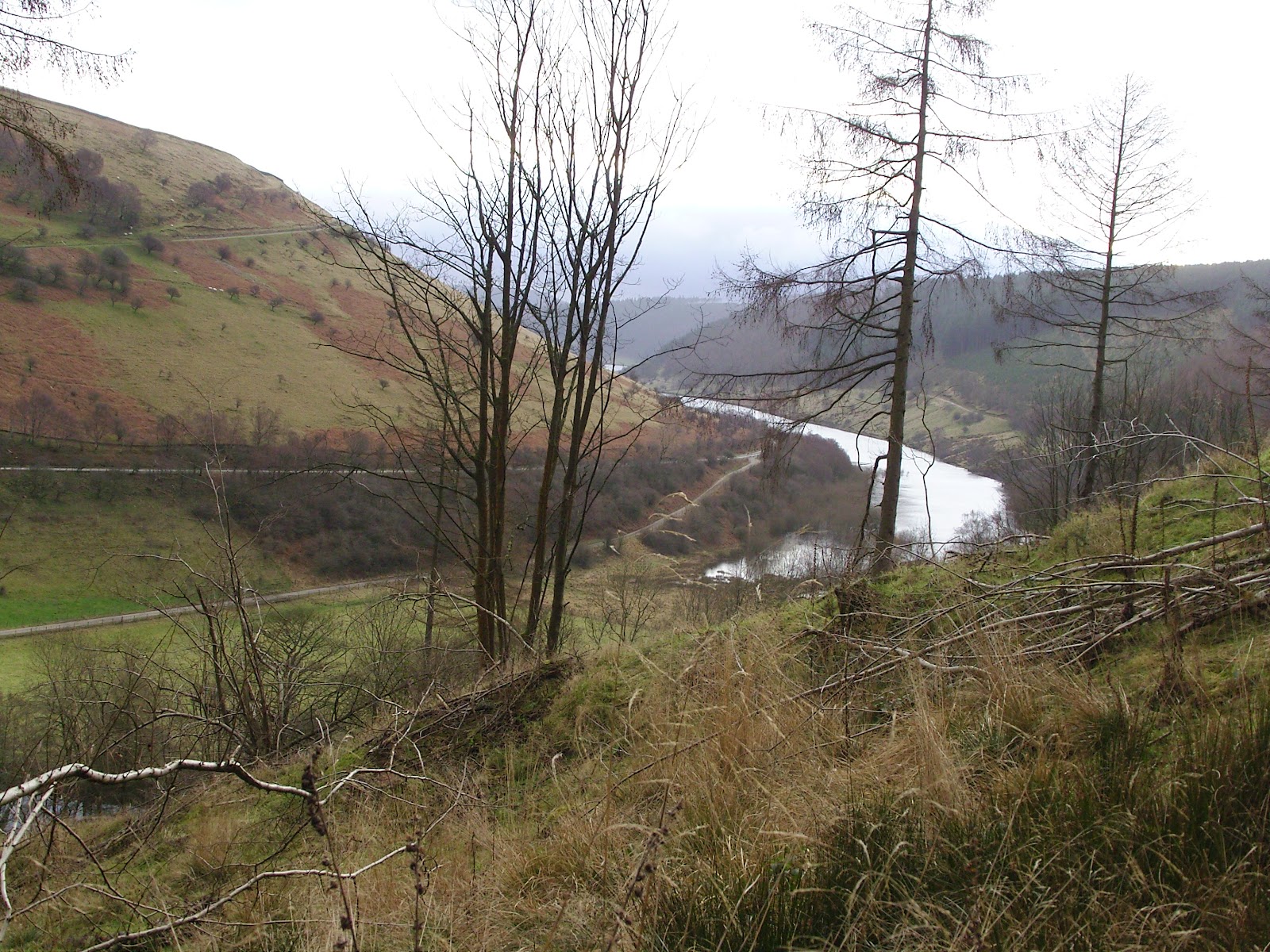

Looking back down the Woodlands Valley over to Ladybower
The road section, despite seeming endless, was not and we crossed the bridge in the Woodlands Valley, just to the north of Hope Cross on the OS map.  There was a slight uncertainty as to which was our path onto Win Hill - our main target for the day.  A short walk ahead confirmed there were no other paths to take and that, coupled with the fact that Len's Path was clearly signed as a route onto the Roman Road, removed any doubt that this steep and dirty trail was the one we should take.

Len's Path, that's Den by the way, not Len
Occasionally we saw dirt-bikers, all of whom Den asserted were off-duty superbikers having a day of fun.  In fact I think we saw all of the following according to Den:


- British Superbike
- World Superbike Champion
- MOTO GP Champion
- TT Champion
- Eddie Kidd
- Evil Knieval


Each of these were on their DT50's with muddied out number plates.  I resisted the urge to stop them for their autographs.  Didn't want to bother them on their days off.


The initial distasteful appearance of Len's Path (now known to me as Den's Path) gave way to a really lovely route which became so at what appeared to be a small settlement at around SK164867.  For some reason I failed to take a photograph here, but I couldn't quite work out what these places were other than long deserted homes.  I wondered if the owners might have been cleared as in the Highlands.  
From these mysterious steadings the path leads through dense conifer plantation (which may or may not confirm my clearance wondering).  Despite my having a real dislike for dense conifer plantation, the path was a joy to walk, being sheltered from the wind and full of atmosphere.  Punctuated with lush and verdant grassy clearings to the southwestern side, this latter section of ascent eased off in steepness as we gained the ridge.  

The coniferous tube of Den's Path
The ridge took us by surprise for it was substantially broader than we expected.  The Roman Road section was largely easy walking and this was borne out by the myriad Sunday walkers in trainers and bomber jackets that materialised shortly after we popped out above the conifer line.


The views over to Kinder were fine at first, but Mother Nature seemed to have her felt pens out and quickly coloured everything to the west in grey.  She spared us for some time along this never-ending, long tongue of a hill.  It was a lovely place to be and I felt like I could have walked along it for hours.   I'd say from the point where we joined it, to the summit rocks, was around 2.5 miles of loveliness.  
There was a varied, sandy terrain of neatly grazed grass, interspersed with tussocks of tougher grasses, and heather in places.  There were several pits which dotted the top of the spur-like plateau and we wondered what they might be.  Evidence of open-cast mining - but of what?  Sink holes?  We remain clueless. 
The highest point is marked by Hope Cross which seems to have had its top stone removed and all that remains is the upright and a metal spike where the top stone once rested.  At least that is what I can glean from a quick Google search. I might have been looking at the wrong marker post I suppose(?).  Anyone got any better info?
Den on the Roman Road - summit bound
Some you Win.  Lose Hill from Win Hill

Grass, Heather, Sand, Erosion, Mist, and Den
After a brief spell of more closed in mist, the air cleared and the winds got up to full strength for the first time so far, the air being compressed on the prominent summit rocks of Win Hill itself.  We'd looked across to this pointy top some ten years earlier and vowed to 'do' it one day.  We never expected it to take us 10 years.  I suppose the Munros and Wainwrights got in the way.


The summit moment was poignant, but brief due to the gale-force battering we were getting so we set off downwards for a steep and very careful descent to Yorkshire Bridge. 


Den in his lovely new Spyder jacket.  The armed guards weren't far away
on account of its ludicrous value.   
Me at the Trig - you'll not believe the number of times that Garmin knocked me on the head.
Note to self - reposition next walk.  It didn't even get switched on!
Although a fabulous setting, the conditions underfoot were less than fabulous - ankle deep mire most of the way.  And folk were coming uphill in shiny white trainers!  I should add that a good many of them were not smiling.  
My trusty Fizan poles had had a good outing and continued to prove themselves by making this descent far less troublesome with them in hand.


We regained our knees for a spell at Yorkshire Bridge and I phoned home with a quick progress report whilst Den caught his breath with a much needed roll-up.  Nuthatches were shouting in the trees above us and as if to tease us, remained disguised by their silhouettes or hidden by the boughs.  A little way up the lane all manner of small songbirds erupted from the trees by the road and my eyes scanned for the cause.  In that moment the culprit, a male sparrowhawk, burst empty-handed from a bramble and flew off along the line of trees.  Doubtless cussing the wasted energy.  There's usually a moment like this on our walks, a real treat.

The next couple of miles along the peakland lanes were a bit of a slog, but I enjoyed getting into the rhythm with my poles.  I paused often to suck up the views down over Bamford, I remember thinking that it was a shame it would soon be over. 

Shortly before we reached the parking spot at Dennis Knoll - a honeypot for Stanage climbers - Den noticed the car, stile a mile or so away.  It was a welcome sight, and given that I couldn't see any bricks supporting the axles, I was all the more pleased.

We slumped into the car, checked the map for a while, scouting a pitch for the night, and headed down into Hathersage to fill the tanks and resupply.  After driving about looking for suitable spots to camp close to the road, we decided that we'd head for the North Lees campsite and pitch there.  It was a little soggy, the facilities were clean and serviceable - although the lights in the loos seemed to be switched off overnight and only came on after dawn - go and figure that one out.  Oh, and there was no cold water either.  Bear this in mind if you are thinking of staying.

Therein lies the tale of my first bit of backpacking in what seemed like an age.  How quickly one can get back into the groove.  Quite apart from the fact that our initial route plan was dumped on day one, we had a great walk, a good wild camp, and a memorable weekend outside.

I hope you enjoyed reading this as much a I did recording it.
Finishing where we started, beneath Stanage Edge.

Friday, 18 November 2011

1 in 420+

That's what I was.  

I found my fate today by both letter and a leak on the challenge forum.  Ok so not exactly a leak as it was a post from John Manning himself.  

I was one of the 420+ people to find out that I am on the standby list.

I had prepared myself for disappointment, expecting not to get on but I have to say I was strangely close to tears.  It was odd, I guess despite openly and outwardly readying myself for the possibility of a 'No' I already had book my place.  In truth, I fully EXPECTED to get on and not getting on was a complete surprise.  

I have lit the tinder of a few new friendships which I hoped to fuel in the coming months, which I can and will still do.  BUT I WANTED TO GET A 'YES'.

I had promised my wife, who really wasn't cherishing 2 weeks without me (although I would have thought she would have had the opposite reaction), that I would withdraw from the standby list.  But I just couldn't resist asking John 'Outdoors' Manning where I stand on that list, so that is what I have just done.  

I don't know what I will do with the number, I suppose it depends what number it turns out to be.

I do have a plan to finish off my round of Wainwrights - I should be able to do 62 in a year if I make a few concerted forays so that is what I plan to do with 2012.

But what if I am number 1, 2, 3......10, 11, 12 on the list?

Sunday, 11 September 2011

Sunday Suffolk Woodland Stroll

I finally managed to squeeze in an afternoon in the countryside today.  It's more about not letting the family down these days.  I can't go off gallivanting when there's work to do leaving the good lady to look after the two little rotters, can I?     


Well today I had a pass, to stretch my legs a wee bit in readiness for a jaunt in the fells in the next week or so.  I was convinced to go with my brother-in-law to do a little walk that I love around Moulton, near Newmarket in Suffolk.


I have to say that I do love the hills, and mountains, and valleys, and gorges etc etc, but I can't ignore the treats in my back yard.  Suffolk has some of the biggest skies around, with genuinely pleasing, smoothly rolling swells of fields and ancient woodland.  My walk around Moulton, Dalham and Gazeley fitted this description perfectly.
The walk is only about 6 or 7 miles, so perfect for a afternoon outing.  The setting at Moulton is quite endearing, with a 14th century packhorse bridge in pristine condition taking pride of place at the middle of this little village.

We had a few wildlife encounters, as we always seem to do on these country walks.  A small, young hedgehog crossed the road - we didn't ask him why - but we carefully lifted, and placed the prickly parcel on the other side of the lane to save any squashing by vehicles.


I stopped to take a look at some vines hanging from the bough of an Ash tree which completely covered the bough, and a Tawny Owl burst out from the centre of the foliage straight towards me, over my head, circled beneath the canopy and then flew off through the woodland. My first daytime Tawny encounter - and a good one too.


The last wild rendezvous was a simple one, a common toad crossed our path.  That's it.  She was a lovely one, young and bright - like she had just been unwrapped.  I couldn't resist picking her up for a closer look.  I began to get all philosophical about her, so I brought myself round and let her hop off into the undergrowth.  


I noticed on the walk through the Dalham Estate that every single large tree on the path was marked with a red plastic tag which had been hammered into the trunk at about eye level.  The tag had a five-digit number with the letters PRN printed beneath in white.  
None of the trees away from the path had any numbers or tags, and I pondered what they might signify.  I wondered if they were navigation marks for the Estate's woodland managers allowing them to pinpoint other trees by using these as reference points.  I'd be glad to hear from anyone who can add any suggestions.


The winds were getting up and rain was threatening to dampen our thus far dry afternoon out.  Hurricane Katia was making noises that she might start battering Britain's Western coasts and counties.  On went the Montane Featherlight jacket to shrug off the looming rainfall.  The changes in the weather seemed to add to the atmosphere of the walk.  After just a spattering of fat droplets, the rain had passed us by and the sun began again to shine.  The last mile of road walking was a bit of a shame, particularly given the cracking woodland surroundings we had just been moving through.  There was a silver lining to the macadamed cloud - The King's Head.


One pint of IPA down the hatch, and back to the village hall where our car was parked, via a huge box of Bramley's that was left outside a house beckoning "please help yourself".  We'd clocked the apples on the way out and made a note to collect some on our return.


They were all gone.
___


http://www.moultonsuffolk.co.uk/index.html - a bit about Moulton - try the Kings Head!


http://www.dalham.com/ - a bit about Dalham


http://www.onesuffolk.co.uk/GazeleyPC/ - a bit about Gazeley


http://greatbarrowchallenge.co.uk/ - a fantastic challenge through the Suffolk countryside (including Gazeley)