Showing posts with label wild camping. Show all posts

Saturday, 7 April 2012

Coming up... ...Wanders from Wonderland

My challenge preparations unfortunately lack much hill work which I am sure to pay for when it is crunch time.  I am putting the distance work in though and my next post will be a full write up of my latest backpacking outing involving some East Anglian stealth camping.  For now, here is a taster...


Thursday, 12 January 2012

Never be afraid to change your plans Pt.2...

So where did we leave it last time?  Oh yes, I was awash with whisky and spaghetti bolognaise by Ladybower...


So we were both awake before dawn, but the first hints of light were beginning to materialise to the northeast.   The pocket rocket was fired up and a brew on the go within a few minutes.  Breakfast was one of those flapjacks that you will have seen on an earlier blog.  Not great, but the chocolate chips helped.  Black coffee always helps to kickstart me in the morning, in more ways than one, so a trip to the wilderness toilet was had.  The turf was replaced and a huge rock placed over it to ensure it didn't escape.  I resisted taking a photo - some things are best left unrecorded.


Today we had decided to walk the shore and join the road at the Ashopton Viaduct which would take us around to the westernmost point of Ladybower.  After the shoreline section, the road was not pleasant, although the A57 was thankfully very quiet with it being early on a Sunday.  


I think my wife must have been praying, because the teawagon on the A57 was there, open and a steaming cup of tea was ready for us to purchase.  A smashing chap runs that wagon - and I urge you to stop by if you are driving through.  Some nice fellas were in front of us, be-gaitered and ready to go off hiking.  One of these men appeared addled, and was clearly confused that he had lost something, but was making no sense when I questioned him.  He was ushered away by his 'pal' who I asked what he had lost - he too said he didn't know.  We came to the conclusion that he had some form of dementia.  That thought stayed with me and troubled me for a while after we left the lay-by.


After being caught short again, I had to catch up with Den who had walked on slowly ahead.  Every time I looked up - he looked back over his shoulder, and started running off.  This he did about a dozen times, until I finally caught up with him.  How we laughed.


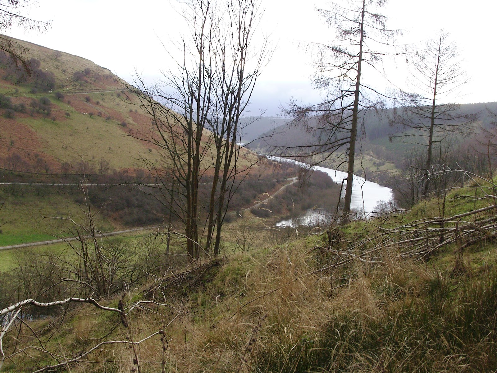
Looking back down the Woodlands Valley over to Ladybower
The road section, despite seeming endless, was not and we crossed the bridge in the Woodlands Valley, just to the north of Hope Cross on the OS map.  There was a slight uncertainty as to which was our path onto Win Hill - our main target for the day.  A short walk ahead confirmed there were no other paths to take and that, coupled with the fact that Len's Path was clearly signed as a route onto the Roman Road, removed any doubt that this steep and dirty trail was the one we should take.

Len's Path, that's Den by the way, not Len
Occasionally we saw dirt-bikers, all of whom Den asserted were off-duty superbikers having a day of fun.  In fact I think we saw all of the following according to Den:


- British Superbike
- World Superbike Champion
- MOTO GP Champion
- TT Champion
- Eddie Kidd
- Evil Knieval


Each of these were on their DT50's with muddied out number plates.  I resisted the urge to stop them for their autographs.  Didn't want to bother them on their days off.


The initial distasteful appearance of Len's Path (now known to me as Den's Path) gave way to a really lovely route which became so at what appeared to be a small settlement at around SK164867.  For some reason I failed to take a photograph here, but I couldn't quite work out what these places were other than long deserted homes.  I wondered if the owners might have been cleared as in the Highlands.  
From these mysterious steadings the path leads through dense conifer plantation (which may or may not confirm my clearance wondering).  Despite my having a real dislike for dense conifer plantation, the path was a joy to walk, being sheltered from the wind and full of atmosphere.  Punctuated with lush and verdant grassy clearings to the southwestern side, this latter section of ascent eased off in steepness as we gained the ridge.  

The coniferous tube of Den's Path
The ridge took us by surprise for it was substantially broader than we expected.  The Roman Road section was largely easy walking and this was borne out by the myriad Sunday walkers in trainers and bomber jackets that materialised shortly after we popped out above the conifer line.


The views over to Kinder were fine at first, but Mother Nature seemed to have her felt pens out and quickly coloured everything to the west in grey.  She spared us for some time along this never-ending, long tongue of a hill.  It was a lovely place to be and I felt like I could have walked along it for hours.   I'd say from the point where we joined it, to the summit rocks, was around 2.5 miles of loveliness.  
There was a varied, sandy terrain of neatly grazed grass, interspersed with tussocks of tougher grasses, and heather in places.  There were several pits which dotted the top of the spur-like plateau and we wondered what they might be.  Evidence of open-cast mining - but of what?  Sink holes?  We remain clueless. 
The highest point is marked by Hope Cross which seems to have had its top stone removed and all that remains is the upright and a metal spike where the top stone once rested.  At least that is what I can glean from a quick Google search. I might have been looking at the wrong marker post I suppose(?).  Anyone got any better info?
Den on the Roman Road - summit bound
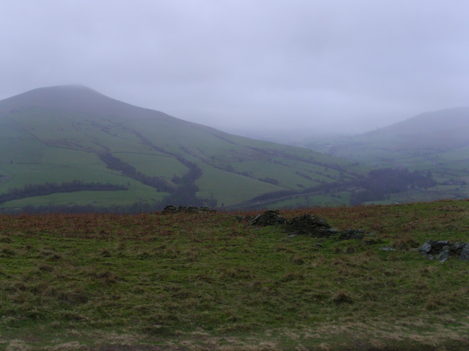
Some you Win.  Lose Hill from Win Hill

Grass, Heather, Sand, Erosion, Mist, and Den
After a brief spell of more closed in mist, the air cleared and the winds got up to full strength for the first time so far, the air being compressed on the prominent summit rocks of Win Hill itself.  We'd looked across to this pointy top some ten years earlier and vowed to 'do' it one day.  We never expected it to take us 10 years.  I suppose the Munros and Wainwrights got in the way.


The summit moment was poignant, but brief due to the gale-force battering we were getting so we set off downwards for a steep and very careful descent to Yorkshire Bridge. 
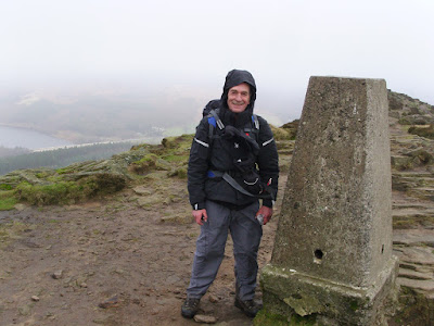

Den in his lovely new Spyder jacket.  The armed guards weren't far away
on account of its ludicrous value.   
Me at the Trig - you'll not believe the number of times that Garmin knocked me on the head.
Note to self - reposition next walk.  It didn't even get switched on!
Although a fabulous setting, the conditions underfoot were less than fabulous - ankle deep mire most of the way.  And folk were coming uphill in shiny white trainers!  I should add that a good many of them were not smiling.  
My trusty Fizan poles had had a good outing and continued to prove themselves by making this descent far less troublesome with them in hand.


We regained our knees for a spell at Yorkshire Bridge and I phoned home with a quick progress report whilst Den caught his breath with a much needed roll-up.  Nuthatches were shouting in the trees above us and as if to tease us, remained disguised by their silhouettes or hidden by the boughs.  A little way up the lane all manner of small songbirds erupted from the trees by the road and my eyes scanned for the cause.  In that moment the culprit, a male sparrowhawk, burst empty-handed from a bramble and flew off along the line of trees.  Doubtless cussing the wasted energy.  There's usually a moment like this on our walks, a real treat.

The next couple of miles along the peakland lanes were a bit of a slog, but I enjoyed getting into the rhythm with my poles.  I paused often to suck up the views down over Bamford, I remember thinking that it was a shame it would soon be over. 

Shortly before we reached the parking spot at Dennis Knoll - a honeypot for Stanage climbers - Den noticed the car, stile a mile or so away.  It was a welcome sight, and given that I couldn't see any bricks supporting the axles, I was all the more pleased.

We slumped into the car, checked the map for a while, scouting a pitch for the night, and headed down into Hathersage to fill the tanks and resupply.  After driving about looking for suitable spots to camp close to the road, we decided that we'd head for the North Lees campsite and pitch there.  It was a little soggy, the facilities were clean and serviceable - although the lights in the loos seemed to be switched off overnight and only came on after dawn - go and figure that one out.  Oh, and there was no cold water either.  Bear this in mind if you are thinking of staying.

Therein lies the tale of my first bit of backpacking in what seemed like an age.  How quickly one can get back into the groove.  Quite apart from the fact that our initial route plan was dumped on day one, we had a great walk, a good wild camp, and a memorable weekend outside.

I hope you enjoyed reading this as much a I did recording it.
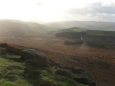
Finishing where we started, beneath Stanage Edge.

Monday, 9 January 2012

Never be afraid to change your plans Pt.1.

Den and I started off on plan, arriving at Hathersage by mid morning.  We wove our way up the lane to Sheepwash Bank beneath Stanage Edge.  The plan was roughly as follows:


1) Get up onto Stanage Edge, walk along it.  


2) Down to the A57, cross it.


3) Up to Derwent Edge, walk along it.


4) Find somewhere to camp up high.


5) Wake up, go down to Ladybower.


6) Over to Hagg Farm (why anyone would want to farm them, I've no idea), then up onto Win Hill to camp 


7) Return to car via the lanes, and paths.


7 easy stages in the wonderful English hills.  The reality had us telling a somewhat different story....


We huffed and puffed, straight out of the car yomping through the bracken, and sloppy sheep trails up to Stanage Edge buffeted all the while by the Westerlies.  Quickly we noticed we both had a permanent list to the Port Bow.


Looking over Dennis Knoll to the Pennines beyond
The going was good underfoot and the views tremendous, we had got lucky.  The sun was shining, and the air was dry.  The hoolie that was blowing, though, made my smooth blue line into a rather wiggly one.  Den and I bounced off the invisible wall of wind, into gritty puddles, and off into the heather.  We could barely even hear the kwok-kwok-kwokking of the grouse over the sound of the rushing air.  Ok, so I might be being a tad over zealous, but I have to - I'm building up to a route change!
Den on Stanage
No really, it is!
We got to the northern end of Stanage Edge, an 'Edge' I've wanted to walk for years and never have and hoofed our way quickly down the be-littered A57 to make our way up to Derwent Edge which we hoped we might get most of the way along before pitching for the night.  The lower altitude, and position away from the edges had made little difference to the effect of the 'breeze' and we paused for a breather, and a bit to eat in the shelter of a stone wall somewhere by Moscar House.  We were both thinking the same thing....  ....we'll camp low tonight.  But where?  


Our thoughts bounced around for a bit and we eventually decided to knock the edges on the head and stay low for the rest of the day. 


Heading up the track by Moscar House, shortly before the decision at 'The Wall'
We pointed out noses more or less South and picked up a footpath that would take us past (but not into) the Ladybower Inn.  We'd find a spot on the western shore of Ladybower, which we generally agreed would be sheltered from most of the blusteriness.
A relatively short section of road walking across the Ashopton Viaduct saw us onto the shore(ish) path of Ladybower itself.  


Plan B was to walk the entire western shore, north of the viaduct scouting for suitable and discreet spots to pitch.  It was still relatively early, with a few hours of daylight left so we knew we would have to linger for a while before getting the tents up.  After earmarking a few ok spots, and one cracker, we pootled up to the picnic area at the northernmost tip of the reservoir.  


Cups of tea were purchased and consumed, I had a large and Den a regular - for I am large, and he is regular.  After discounting the picnic area itself as a spot to settle for the night (on account of the CCTV cameras and millions of people and rangers office, etc. etc.) we retreated to the cracker spot we had seen on the way up.  Still in daylight and frozen stiff on account of the wind chill, we loitered without tent for what seemed like a yonk or maybe more.  You see, we needed the light to fade enough to conceal our camp making activities.  The whisky found its way out of its bottle by about 4pm and strangely we found the courage to say 'sod it', and pitched the tents anyway.  We had a few excuses at the ready, just in case an officious type tried to move us on, but thankfully they weren't required.  
Den's trusty Vaude from my trusty Tarptent
By 7pm we were both asleep and although our spot was sheltered, we came in for a bit of a gusty battering nonetheless.  Many very strong punches of what seemed like gale force winds hit us that night, but in spite of these attacks, we snatched a good few stretches of slimber between us.  I suspect the Whisky and the rather large helping of Spaghetti Bolognaise helped me on my way.  I spent the waking moments wondering what it might have been like had we stayed on the tops.
This was my rushed attempt at one of those TerryBND shots


I think that'll do for this post - I'm getting tired of it myself so I'll stop for now and do part 2 another day.  Bet you can't wait ;-)

Wednesday, 14 December 2011

KITLIST V1.1

TGO Challenge Kit List laid out - awaiting judgement.
Following a few comments on my previous post, here is my kitlist for your scrutinous pleasure.  This is for day one with 6 days of grub in it.  In fairness I probably wont need to carry it all on day one, but that's where you lot come in.


Be kind, be humourous, and if you can be helpful at the same time, so much the better!


Category Item Weight (g)
Baselayer Technicals L/S Baselayer 210
Baselayer Baggie 15
Communication Nokia 1616 Mobile 75
Cooking Trangia 1l Kettle 175
Cooking Lifeventure Titanium Mug 60
Cooking Long Handled Spoon 15
Cooking MSR Pocket Rocket 75
Cooking Matches & Lighter 20
Cooking Gas Cart 500
Cooking Sea to Summit Baggie 25
First Aid First Aid Kit 90
First Aid Painkillers and Anti Diarrhoea 80
Food Be-well Exped Main Meal 180
Food Be-well Exped Dessert 130
Food Wayfayrer Dessert 200
Food Be-Well ChocChip Flapjack 115
Food Smash Packet 175
Food Smash in Clip Top Container 175
Food Beef Jerky 100
Gloves Karrimor Gloves 50
Gloves Trekmates Silk Liner Gloves 25
Headgear Lowe Alpine Mountain Cap GTX 75
Headgear 2 x BUFF 75
Hydration 2ltr pop bottle 50
Hydration 2ltr platy 30
Hydration 2l water 2000
Hygiene MSR Pack Towel 30
Hygiene Nivea 4 Men Cool Kick 35ml Antiperspirant 35
Hygiene Small Bottle of Lifeventure All Purpose Soap 35
Hygiene Sunscreen 30SPF 25
Hygiene Smidge 75ml 85
Hygiene Loo roll 30
Hygiene Wet Wipes 45
Hygiene Kitchen Roll (10 Sheets) 15
Hygiene Sea to Summit Baggie 20
Insulation PHD Yukon Jacket 550
Insulation Montane Chuckchi Microfleece 230
Navigation Silva Expedition 4 Compass 45
Navigation Garmin Geko 201 (inc case) 110
Navigation Printed OS sheets in plastic case 320
Navigation Moleskine Notepad (Navigation Notes) 40
Odds & Sods Length of Dyneema 25
Odds & Sods Alpkit Carabiner (for the dyneema) 15
Odds & Sods Baladeo 22g Pocket Knife 22
Odds & Sods Spare Lighter 15
Odds & Sods Front Door Key 25
Odds & Sods Wallet & Cash 100
Outer Shell Mountain Hardwear Paclite Trousers 300
Outer Shell Mountain Equipment Changabang XCR 625
Power & Light 6xAAA Lithium Batteries & 3 x CR2032 65
Power & Light Petzl eLite 25
Power & Light DSL Mini Alu Light 10
Power & Light Spare Mobile Battery 20
Reading Kindle (inc protective case) 340
Rucksack MACPAC Pursuit Classic (Size 3) 1900
Shelter Tarptent Moment (including 4xAlpkit Spike Pegs) 1040
Sleeping Pacific Outdoor Equipment Ether Thermo 6 575
Sleeping Golite Ultralite 3-season Quilt 700
Trekking Fizan Compact Ultralight Poles 335
Trousers Pair of Running Leggings 225
Trousers Baggie 15
Underwear Tilley Underpants 45
Underwear Bridgedale Hiker Socks 110
Underwear bridgedale Hiker Socks 110
Underwear Helly Hansen Baselayer 130
Underwear Baggie 15
Writing Moleskine Notepad (journal) 40
Writing Staedtler Pigment Liner 0.1 15
Writing Baggie 10
Total
15692


Food 6-days 3340
Water Max Carried 2000


F & W Total
5340


Base Weight
10352


Now awaiting critique..............

Tuesday, 13 December 2011

18.... ....14.3.... ....150

I went on a walk today. 


Last night I packed up my rucksack with everything.  That's it - everything that I planned to take on TGOC 2012 with me.  I weighed it and no matter how many ways I hung it from the luggage scales it was HEAVY - 18kg!


18 is just a number after all so I thought it best to test the number on the trail.  So I got my walking machine pal Den out of his box, dusted him off and we headed into the East Anglian countryside once more.  Day one on the challenge for me will be at worst a 15-miler so I thought I had better do a bit of a comparison.  I roughed out a circular route from Kirtling which was about that - 14.3 miles if you are interested.


At 0730h I picked Den up and we drove to our start point, parking just outside some houses in Kirtling village itself, wanting for a better spot to leave car, but the side of the road it had to be.  It was cold, and the wind didn't make it any better.


I forgot to take any pics on the first section of this walk, but I managed to drag the camera out of its pouch as we entered some paddocks.  Here is an uninteresting shot, but it is a shot of where we walked nonetheless.


Some paddocks not far from Kirtling
My pack felt very heavy on my shoulders, and my back was protesting.  Not a good sign, but I persevered.


The paddocks finally allowed us to squeeze from their grip and we popped out into the open.  Den was sporting a very nice bobble hat which he assured me was keeping him very warm.  It's one of those hats that is so wrong, it was swinging back to being right again.  A real hum-dinger.


Bobbles, and a Spyder
My pack was still feeling heavy, and not all that comfortable.  I made some adjustments, and it instantly felt better.  I forgot about it for a while, which was a better sign.  
Some shenanigans with OFFICIAL PATH EXTINGUISHMENTS got our goats up a wee bit - as is increasingly typical with the footpaths round our way.  The signs only seem to be obvious on the side from which we are NOT approaching!  Nevertheless a quick alteration to our route allowed the new footpath to spit us out onto the road about half a mile back from our intended point.  Cussing the now extended road section, and moaning about the failed promise of wild animals (see photo below) we marched on regardless through the lanes until the little green sign showed us back to the field margins, and on to Back Street where we stopped for an early bite to eat, and a brew.


Wild Animal?
Me having tea.
If I have a favourite place to walk in East Anglia, it has to be the narrow hedgerow-lined avenues.  Wooded either side, and leafy underfoot at this time of year - lovely.
Shortly after we set off, we agreed to make a note of the wild camping opportunities that we came across during the day.  These little avenues offered the greatest opportunity, and we knew that in summer we would be able to nip into the spinneys and copses to camp unnoticed by passers by.  In total, we counted six great spots in fourteen miles, plus a couple of questionable pitches, which would go at a push.  Not a bad result and worth noting for those of you who live near the National Parks but want to try a long-distance walk somewhere completely different.  I recommend it thoroughly having done several myself.  So long as you are canny, considerate, covert and stealthy and are willing to hang around until dusk before you pitch, and can be away at dawn, all will be well.


One of those wood-lined paths, wildcamping opportunities aplenty.
We managed few wildlife encounters, with raptors leading the count, seconded by winter thrushes and then finches.  Several Buzzards, a couple of Kestrels, and a Sparrowhawk followed by countless Fieldfares and Redwings in the treetops.  The finches were mainly Goldfinches and they decorated the bare twigs like Christmas trinkets.  One such tree had its own female Bullfinch bauble.  Lovely.
A muntjac was the only mammalian offering of the day (other than the Grey Squirrel but I don't count those - I am a mammal snob, you see).


The pack became awkward again, and this time no amounts of adjustment would alleviate the discomfort.  Luckily we had reached the latter stages of our route and we had by now swapped the tacky dough of clay for grassy verge and back-road.  Much easier from a navigational point of view, it offered a glimpse at some of the more opulent properties that speckle the rural lanes of our county.
Another shot of our only real pause for relaxation.
I can summarise that my legs and feet were tickety-boo with forty pound on my back.  My shoulders weren't really as tender as I had expected, but my back felt compressed.  I put this down to the fact that I couldn't get the belt tight enough on the pack to stop it sliding down my hips.  The result was to transfer all of the weight onto my shoulders.  The straps are really good on the pack, so the shoulders were unharmed, but my back really felt it.  I'm not relishing the thought of a few days with so much weight bearing down on me.  My plan now is to get the pack weight down once more.  If any of you have any ideas I'd be grateful to hear your views on how you go about packing.


Me and my burden, er bergen?
Maybe I should post the gear list as I had it on this day?


At least I have 150 days left in which to get this right!